Discover how road authorities digitally regain
control with Online Traffic Management
This morning, RTL Nieuws headlined in an extensive article that navigation systems like Google Maps and Waze cause cut-through traffic and nuisance. The article paints a picture in which the road authority is a powerless victim of smart algorithms. And although there is certainly a grain of truth to that, it is not the whole story. Did you know that as a road authority, you can actually use these systems to digitally regain control over the road network?
Cut-through traffic: local versus unfamiliar traffic
To tackle the problem effectively, we first need to distinguish between the types of traffic. Cut-through traffic typically consists of two groups, namely local traffic that knows the roads themselves and locally unfamiliar traffic that seeks an alternative route via navigation. Navigation systems offer excellent opportunities to accurately steer traffic flows in this regard. Where traditional, physical detour routes are rigid, starting at a point where you are not and ending where you do not need to be, navigation offers the option to facilitate countless dynamic detour routes. Service providers then ensure that traffic, based on the data, is distributed as efficiently as possible across the road network and available routes.
How do you get a grip on these digital routes as a road authority? The key to success lies in implementing the right, legally supported traffic measures. For effective traffic management, it is necessary that measures also have a legal framework. By temporarily designating roads or areas for local traffic only, you give navigation systems a clear instruction. Navigation systems generally adopt these legal frameworks very well. Local traffic is difficult to divert, but unfamiliar traffic is thus proactively kept away from vulnerable areas.
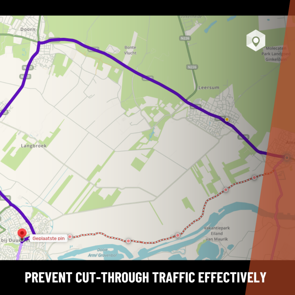
Practical examples
Through our digital collaboration with platforms like Waze, Google Maps, and TomTom, we have now worked on more than a hundred projects where we were able to effectively reduce cut-through traffic. We see some tangible current examples in Noordoostpolder (both in permanent situations and during temporary roadworks) and in Wijk bij Duurstede. Additionally, we work successfully with important partners, such as BUKO. Investing in this collaboration with navigation services offers road authorities direct communication with the road user and flexibility in changing circumstances.
Prevent surprises
But it doesn’t stop here. Road authorities are sometimes still surprised by the route choices of navigation users. This is solved by our Dry Navigation tool. With this, you gain insight into how navigation systems are likely to respond to planned traffic measures, even before execution. As seen in the RTL Nieuws video, the province of Noord-Holland is already successfully using this to simulate routes before the physical measures even come into effect. This lets you know immediately whether the desired traffic flow is supported, or if additional measures are needed.
Do you want to regain control of the road network and keep out unwanted traffic?